Blog

  • The World’s Most Remote Places Where People Still Live

    The World’s Most Remote Places Where People Still Live

    In a world that’s increasingly connected by roads, satellites, and Wi-Fi, it’s easy to forget there are still places that remain almost untouched by modern life. Scattered across deserts, mountains, islands, and polar regions are communities living far from the crowds, often in isolation that shapes every part of their existence. These remote places are not just geographical curiosities—they’re home to people who have adapted to harsh climates, limited resources, and incredible distances from the rest of the world. Here are some of the most remote inhabited places on Earth.

    Tristan da Cunha, a volcanic island in the South Atlantic Ocean, is considered the most remote inhabited archipelago in the world. Home to fewer than 300 people, it lies over 1,700 miles from South Africa and 2,000 miles from South America. There’s no airport—reaching it requires a seven-day boat trip. The residents live off farming, fishing, and occasional tourism, and life here is tightly knit and deeply self-reliant.

    Ittoqqortoormiit, Greenland, is one of the most isolated towns in the Arctic. Surrounded by sea ice for much of the year, it has fewer than 500 residents. Hunting, fishing, and dog sledding are still vital parts of daily life. The nearest neighboring settlement is hundreds of miles away, and there are no roads connecting it to the rest of Greenland. It’s a place where the silence of snow-covered landscapes stretches for endless miles.

    La Rinconada, Peru, sits high in the Andes at nearly 17,000 feet above sea level, making it the highest permanent human settlement in the world. Isolated by altitude and terrain, the town is home to thousands of gold miners who brave harsh conditions and low oxygen levels for a chance to earn a living. There are no running water systems, and infrastructure is basic. Yet life continues in this otherworldly corner of the planet.

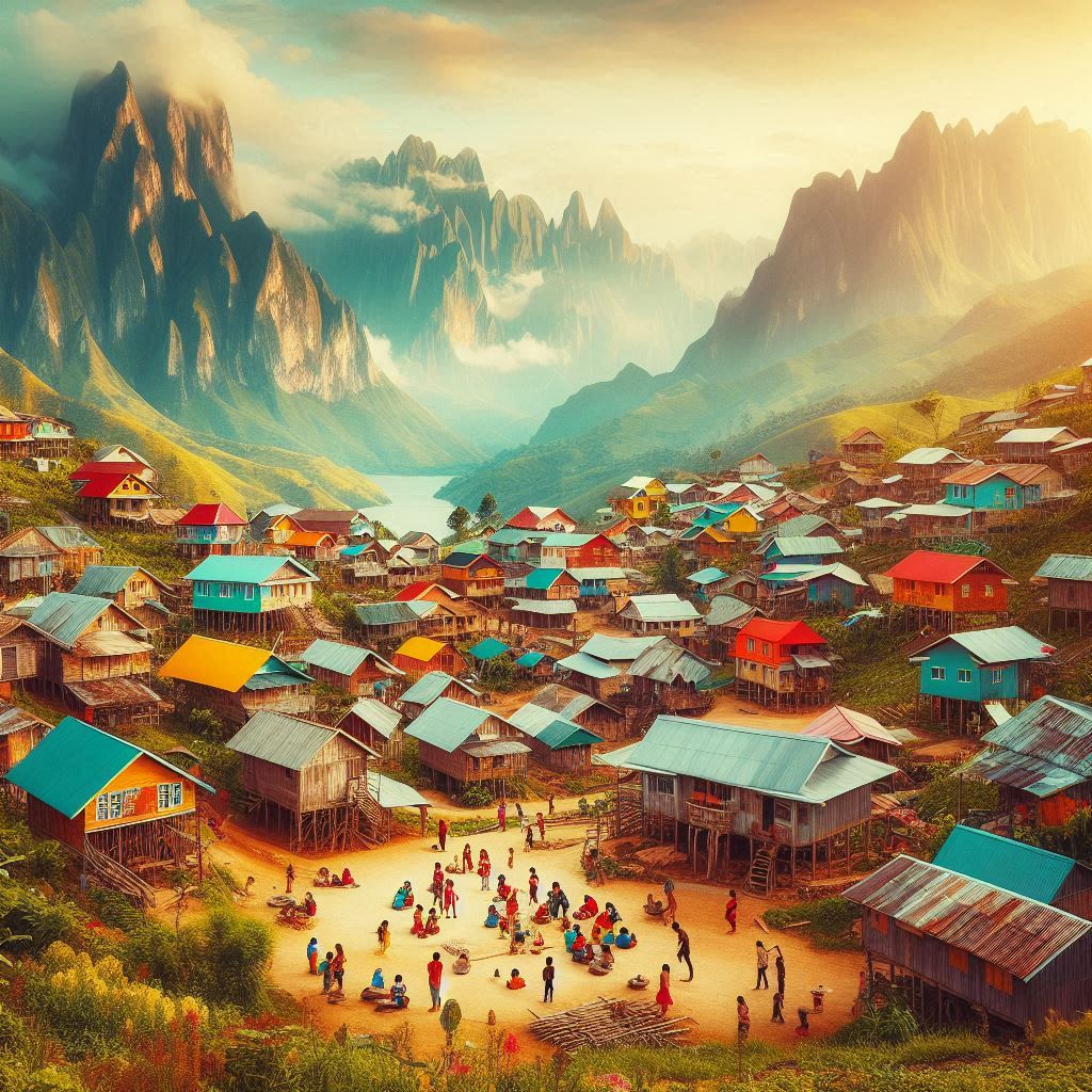
    Supai, Arizona, is the only place in the U.S. where mail is still delivered by mule. Located within the Grand Canyon, the village is accessible only by an 8-mile hike, helicopter, or horseback. It’s home to members of the Havasupai tribe, who have lived in the area for centuries, surrounded by towering canyon walls and turquoise waterfalls. Supai is not just remote—it’s rooted in deep cultural heritage.

    Longyearbyen, Norway, is the northernmost town in the world, located on the Svalbard archipelago. Life here is extreme, with months of darkness in winter and 24-hour daylight in summer. Despite its remoteness, it has a small international community, a university, and even a seed vault meant to protect the future of global agriculture. Still, polar bears outnumber people, and everyone carries a rifle when venturing outside town.

    Pitcairn Island, in the South Pacific, has a population of fewer than 50 people—all descendants of the famous Bounty mutineers and their Polynesian companions. It’s a British Overseas Territory, and getting there requires a long sea voyage. There are no airstrips, and supply ships visit only a few times a year. Despite this, the island has internet, a school, and a strong sense of community.

    Oymyakon, Russia, is known as the coldest inhabited place on Earth. Located in Siberia, temperatures here can drop below -60°C (-76°F) in winter. The ground is permanently frozen, yet about 500 people call this place home. Life revolves around keeping warm, preserving food in the frozen earth, and enduring the long, brutal winters.

    Alert, Canada, is the northernmost permanently inhabited place on the planet. Located just 500 miles from the North Pole, it’s a military and research station staffed by a small crew. Conditions are extreme, and the isolation is intense. Yet for scientific research and defense operations, Alert plays a critical role.

    In these remote corners of the Earth, people live lives shaped by nature, not convenience. Whether driven by tradition, survival, or solitude, their resilience offers a powerful reminder that human life can thrive in even the most unexpected places. As the world becomes increasingly connected, these communities hold on to a rare kind of distance—and the unique way of life that comes with it.

  • Countries That Have Changed Names (And Why)

    Countries That Have Changed Names (And Why)

    A country’s name is more than just a label on a map—it reflects identity, history, and values. Over the years, many nations have changed their names for reasons ranging from independence and decolonization to political shifts and cultural revival. These changes often signal deeper stories about who these countries are and who they want to be. Here are some notable examples of countries that have changed their names—and the reasons behind those changes.

    Burma became Myanmar in 1989 when the ruling military government changed the name to reflect what they considered a more inclusive national identity. “Burma” was closely tied to the majority ethnic group, the Bamar, while “Myanmar” is a more formal version of the same name in the Burmese language. Some countries resisted the change for years, citing the government’s lack of legitimacy, but today “Myanmar” is widely used internationally.

    Ceylon became Sri Lanka in 1972, after gaining independence from British rule. The name “Ceylon” was a colonial legacy, while “Sri Lanka” translates to “Resplendent Island” in Sanskrit. The change was part of a broader movement to reclaim national identity and break from colonial ties.

    Persia became Iran in 1935 at the request of the country’s then-leader, Reza Shah. “Iran” means “Land of the Aryans” and is how the country is referred to in Persian. The goal was to emphasize the nation’s pre-Islamic heritage and unite its diverse ethnic groups under a modern national identity.

    Swaziland became Eswatini in 2018, a change announced by King Mswati III to mark 50 years of independence from Britain. “Eswatini” means “Land of the Swazis” in the local language, and the king stated that the old name was too often confused with Switzerland. The new name reflects pride in the country’s native language and traditions.

    Holland is now the Netherlands, officially. Though the name “Holland” was commonly used worldwide, it actually referred to just two provinces—North and South Holland. In 2020, the Dutch government launched a campaign to promote the use of the correct name, “The Netherlands,” to present a more unified image globally.

    Macedonia became North Macedonia in 2019 after a long-standing dispute with Greece. Greece objected to the name “Macedonia,” as it is also a historical region in northern Greece. The agreement to add “North” cleared the path for North Macedonia to join NATO and continue its journey toward European Union membership.

    Upper Volta became Burkina Faso in 1984, under President Thomas Sankara. “Burkina Faso” combines words from two local languages and means “Land of Incorruptible People.” The change was part of Sankara’s push for African self-determination and a move away from colonial-era names.

    Zaire became the Democratic Republic of the Congo in 1997 after the fall of Mobutu Sese Seko’s regime. The name “Zaire” had been imposed by Mobutu in a campaign to promote “authentic” African identity, but after his overthrow, the country reverted to its earlier name, reflecting a new political direction.

    Rhodesia became Zimbabwe in 1980 after gaining independence from British colonial rule. “Rhodesia” was named after colonialist Cecil Rhodes, while “Zimbabwe” comes from Great Zimbabwe, the ruins of a historic African city and a symbol of indigenous culture and heritage.

    Kampuchea returned to Cambodia, especially after the fall of the Khmer Rouge regime. The name “Kampuchea” was used during that dark period, but the country chose to re-establish its international identity with the more familiar “Cambodia,” especially as it began rebuilding and opening up to the world.

    Each of these name changes reflects more than a linguistic shift—they represent moments of transformation, new beginnings, and the reclaiming of identity. As countries evolve, their names often follow, telling the world something new about the people and history behind their borders.

  • Smallest Countries in the World—and Why They Exist

    Smallest Countries in the World—and Why They Exist

    When we think of countries, we often picture sprawling nations with vast landscapes and millions of people.

    But not every country takes up pages in an atlas. Some are so small, you could walk across them in minutes.

    Yet despite their size, these nations have their own flags, governments, and unique histories.

    Here’s a look at some of the smallest countries in the world—and the surprising reasons they exist.

    Vatican City: holds the title of the world’s smallest country, measuring just about 0.17 square miles. Nestled within the city of Rome, it’s the spiritual center of the Catholic Church and the home of the Pope. It became an independent city-state in 1929 with the signing of the Lateran Treaty. Its purpose isn’t economic or military—Vatican City exists purely for religious leadership and governance of the global Catholic community.

    Monaco: the second smallest country, is a glamorous strip of land on the French Riviera, covering just 0.78 square miles. Despite its tiny size, it’s one of the richest countries in the world per capita. Monaco’s independence dates back to the 13th century, and it continues today under the rule of the Grimaldi family. It survives as a sovereign state largely due to diplomatic agreements with France and its unique appeal as a tax haven and luxury destination.

    Nauru: located in the Pacific Ocean, is the smallest island country in the world. With an area of 8.1 square miles, it has no official capital and one of the smallest populations of any country. Once rich from phosphate mining, Nauru’s economy has declined, but it remains an independent nation since gaining independence from a UN trusteeship in 1968. Its existence reflects the geopolitical reshaping of the Pacific after World War II.

    Tuvalu: is another island nation in the Pacific, only slightly larger than Nauru. At just 10 square miles, it has a small population and limited natural resources. Tuvalu became independent from the United Kingdom in 1978. Its sovereignty is largely preserved by international recognition and its valuable .tv internet domain, which generates national revenue. It also plays a vocal role in global climate discussions due to rising sea levels threatening its existence.

    San Marino: entirely surrounded by Italy, claims to be the oldest republic in the world, founded in A.D. 301. With a land area of just over 23 square miles, it has maintained its independence through centuries of European conflict by staying neutral and negotiating cleverly. Today, it thrives on tourism and crafts, with a deep sense of national pride despite its size.

    Liechtenstein: tucked between Switzerland and Austria, is just 62 square miles in size. A constitutional monarchy, it became fully sovereign in the 19th century. Liechtenstein is now known for its strong banking sector, low taxes, and Alpine charm. It exists thanks to a mix of strategic diplomacy and economic adaptation.

    The Marshall Islands: might be better known for their history of nuclear testing during the Cold War than their small size, but at 70 square miles spread across 29 atolls, it’s one of the smallest nations in land area. It gained independence from the U.S.-administered Trust Territory of the Pacific Islands in 1986 and has maintained a Compact of Free Association with the United States ever since.

    These countries may be small in area, but their histories are rich, and their presence on the global stage is very real. They exist for unique reasons—strategic geography, colonial legacy, religious significance, or cultural resilience. Their stories show that in the world of nations, size doesn’t always determine influence or identity.

  • 25 Mind-Blowing Geography Facts You Didn’t Learn in School

    25 Mind-Blowing Geography Facts You Didn’t Learn in School

    Geography is more than just maps and capitals—it’s full of surprises, extremes, and hidden wonders that often get left out of textbooks. From disappearing lakes to places where you can stand in two continents at once, the world is packed with incredible facts that will make you see our planet in a whole new light. Here are 25 mind-blowing geography facts you probably didn’t learn in school.

    1. There’s a town inside a meteor crater—Winslow, Arizona is home to Meteor Crater, one of the best-preserved meteorite impact sites in the world.
    2. Canada has more lakes than the rest of the world combined, with over 2 million lakes covering around 9% of its total area.
    3. Iceland is growing—the Mid-Atlantic Ridge runs right through it, causing the island to slowly split apart and expand each year.
    4. Africa is the only continent in all four hemispheres, stretching across the northern, southern, eastern, and western hemispheres.
    5. Mount Everest grows every year, thanks to tectonic activity. It’s rising at a rate of about 4 millimeters per year.
    6. Alaska is the westernmost, easternmost, and northernmost U.S. state—it crosses the International Date Line.
    7. There’s a point in the ocean called Point Nemo that’s so remote, the nearest humans are often astronauts on the ISS.
    8. Russia is so big it spans 11 time zones, but it only officially uses 9 for practical reasons.
    9. The Amazon River once flowed in the opposite direction, from east to west, before the rise of the Andes changed its course.
    10. There are more pyramids in Sudan than in Egypt—over 200 of them, built by the ancient Nubian civilization.
    11. You can sail from the Atlantic Ocean to the Pacific without a canal, via Canada’s Northwest Passage—though it’s only possible when the ice melts.
    12. Continents move at about the same speed as fingernails grow, roughly 2.5 cm per year.
    13. The Dead Sea is shrinking rapidly, losing more than a meter of water depth every year due to water diversion and mineral extraction.
    14. There’s an underwater waterfall near Mauritius, created by sand and silt falling off an ocean shelf.
    15. Bangkok’s full name is the longest city name in the world, with a ceremonial name made up of over 160 characters in Thai.
    16. Libya is 99% desert, yet it once had vast underground aquifers and was home to green farmland in ancient times.
    17. The driest place on Earth isn’t a desert—it’s Antarctica’s Dry Valleys, which haven’t seen rain in over 2 million years.
    18. There’s a village in Norway that doesn’t get sun for months, so they installed giant mirrors on a mountain to reflect sunlight into the town square.
    19. At the equator, you weigh slightly less due to the centrifugal force of Earth’s rotation.
    20. The Pacific Ocean is shrinking, while the Atlantic Ocean is slowly getting wider due to plate tectonics.
    21. Lake Baikal in Russia is the world’s deepest and oldest freshwater lake, holding 20% of the world’s unfrozen freshwater.
    22. France borders more countries than any other European nation, including several overseas territories.
    23. There’s a town in Spain that’s surrounded on all sides by cliffs, making it look like it’s carved into the rocks—this is Ronda, in Andalusia.
    24. Some islands in the Philippines rise out of the sea by several inches during low tide, revealing land that disappears again when the tide returns.
    25. There’s a place where you can swim in two continents at once—Iceland’s Silfra fissure lies between the North American and Eurasian tectonic plates.

    Our world is full of unexpected marvels—many hiding in plain sight. Whether you’re a trivia fan, a traveler, or just a curious mind, these facts remind us that geography is anything but boring.